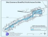
FORT WORTH AVENUE DEVELOPMENT GROUP VISION – DECEMBER 2003
The Vision for West Commerce and Fort Worth Avenue corridor created by area stakeholders and by the all-volunteer Fort Worth Avenue Development Group. Publication includes Conceptual Land-Use Planning Study and Project Summary and Final Report.
The corridor’s former zoning ran the gamut from IM and IR (the City’s heaviest industrial zoning categories) in the eastern section of the corridor from roughly N. Beckley to Sylvan through CS (community services, a category that includes businesses such as auto-repair and bus stations), to CR (community retail), and RR (regional retail) as the corridor runs from east to west. The FWADG’s first priority was to seek out a common vision for a redeveloped corridor that capitalizes on the area’s proximity to downtown and the Trinity River redevelopment as well as long-established North Oak Cliff neighborhoods and the Design District. This common vision was established through a series of land use studies, a planning charrette, and the work of a steering committee that created Planned Development District PD 714 that codified this community’s vision for itself moving forward. The PD was presented to the community in a series of meetings that led to its passing by the Dallas City Council in February of 2005.
FORT WORTH AVENUE DEVELOPMENT GROUP HISTORY PIECE – NOVEMBER 2007
We created this simple handout for participants in the Fort Worth Avenue charrette that contained snippets and images from West Dallas/North Oak Cliff history. The piece was published on October 26, 2002.
LAND USE STUDY – NOVEMBER 2007
The Land Use Study is a master plan for the West Commerce/Fort Worth Avenue corridor that was been created by a committee of nearby homeowners and commercial property owners. Appointed by the City of Dallas, the committee has included representatives from every ethnic group and neighborhood that lives and/or works near Fort Worth Avenue. The master plan divides the corridor into sub-districts, and then identifies what will in the future be considered conforming land uses/business types for each sub-district. The City Plan Commission unanimously approved the Land Use Study in December of 2004 and the City Council adopted it on January 26, 2005.
LAND USE ORDINANCE – JANUARY 2008
The Land Use Ordinance and new zoning map turns the recommendations contained in the Land Use Study into enforceable law. Although existing business with certificates of occupancy are able to remain as they are, the ordinance prohibits new, non-conforming businesses from locating on the corridor. It also prevents existing businesses from changing to a non-conforming type of use. City Council unanimously adopted the ordinance in February 2005, just after its approval from the City Plan Commission.
Trinity Overlook Park: The Trinity Overlook serves as a neighbor “pocket park” that provides access to the Dallas Floodway and the Trinity Skyline Trail.

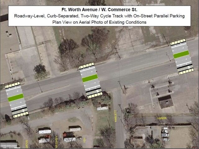
Fort Worth Avenue Thoroughfare Plan Amendment: The Dallas City Council on September 11th unanimously passed a thoroughfare plan amendment for Fort Worth Avenue. The illustration shows the proposed conceptual design for the roadway configuration.
Fort Worth Avenue TIF District: The Fort Worth Avenue TIF District is the gateway from downtown Dallas to West Dallas, generally bounded by commercial and multifamily developments along the Fort Worth Avenue corridor between the Trinity River and Hartsdale Avenue.
Fort Worth Ave Zoning – PD 714: PD is short for planned development. Planned Developments are special zoning written for specific areas as opposed to standard zoning that can be applied to any area. More specifically, PD 714 is a mixed use, form based zoning area. It flanks Commerce Street and Fort Worth Avenue from the levy to Westmoreland Road. The rezoning effort began back in 2005 when the newly formed Fort Worth Avenue Development Group started an effort to revitalize the corridor. Much of the area at the time was zoned IR or Industrial Research. This zoning designation is meant for manufacturing and industrial uses and is the second “heaviest” industrial categorization behind industrial manufacturing or IM.
Download its related exhibits.
